The ThemaMap project main goal is to provide a friendly and versatile thematic cartographic tool available as an OpenSource free software. It is developped by the GREYC in collaboration with the SAIC-CERTIC and the CRH.
ThemaMap is an extension of OpenMap.
The last version is available for download here.
The ThemaMap project main goal is to provide a friendly and versatile thematic cartographic tool available as OpenSource free software. In a few clicks, the user may browse and configure the data source and can easily specify thematic data visualizations. Main characteristics of this system is to allow multiple data sources and multiple visualization types.
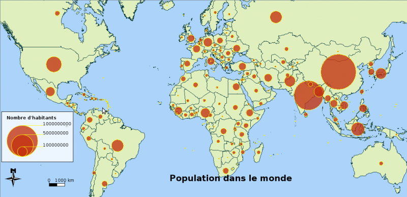
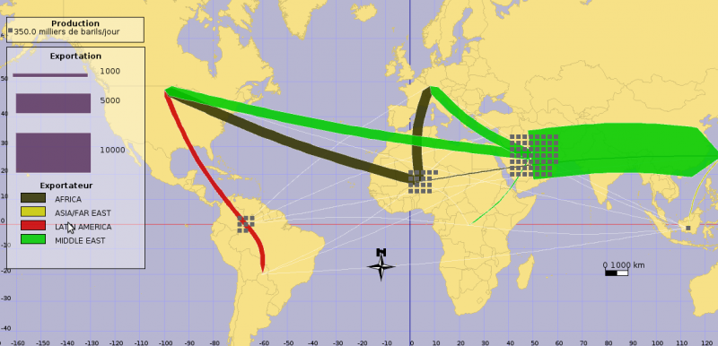
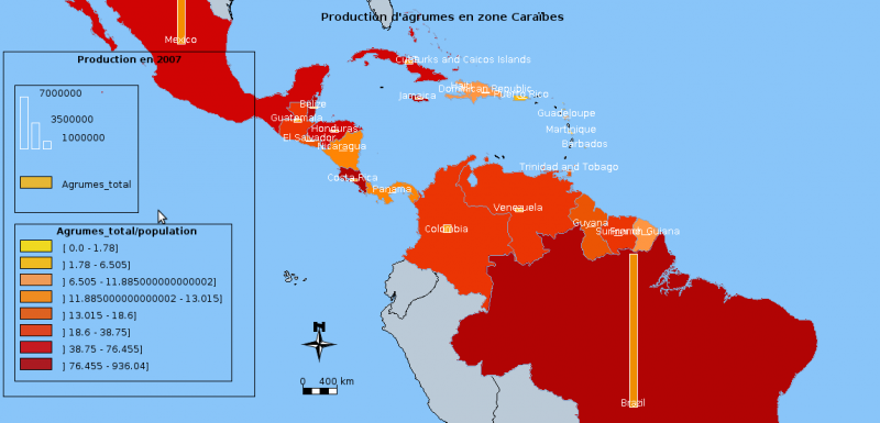
In order to construct a map the user simply starts by choosing its geographical data source. It can be either a shape file with its dbf file companion, a SQL table extraction from a PostGis database or a simple CSV file. At this point, a first raw visualization of the geometry is displayed. The user may then add other thematic visualizations such as: choropleth, colored and proportional discs, pies, histograms, …
The steps of the map construction can be stored in a text file, in order to be later reloaded. This feature allows to actualize the map as data change. One can then export the map to raster image (jpeg or gif) or to SVG vectorial image.
ThemaMap is an extension of OpenMap. OpenMap(TM) is provided by BBN Technologies as an Open Source JavaBeans(TM) based programmer’s toolkit. It manages geographical information among several independent layers. It features projection management, allowing easy panning and zooming. It offers specific beans for each layer. Each layer must implement the data extraction and the abstract graphic construction, OpenMap mapbean doing the final visualization.
Openmap allows easy deployment as a stand-alone application or as an applet available on the Web. Unfortunately, available layers are all specific to one data source format. Therefore, specific data visualization features are available only for one data source type. Our contribution in this software extension is of two orders : data sources abstraction and thematic map construction.